
Planning to hike the Santa Maria Volcano Guatemala? I can absolutely recommend it! In this complete guide, you’ll find everything you need to know about hiking the Santa Maria Volcano.
Santa Maria volcano Guatemala guide

Introduction
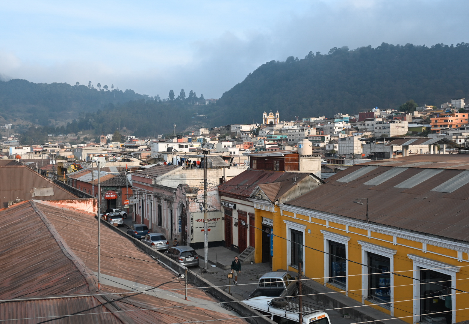
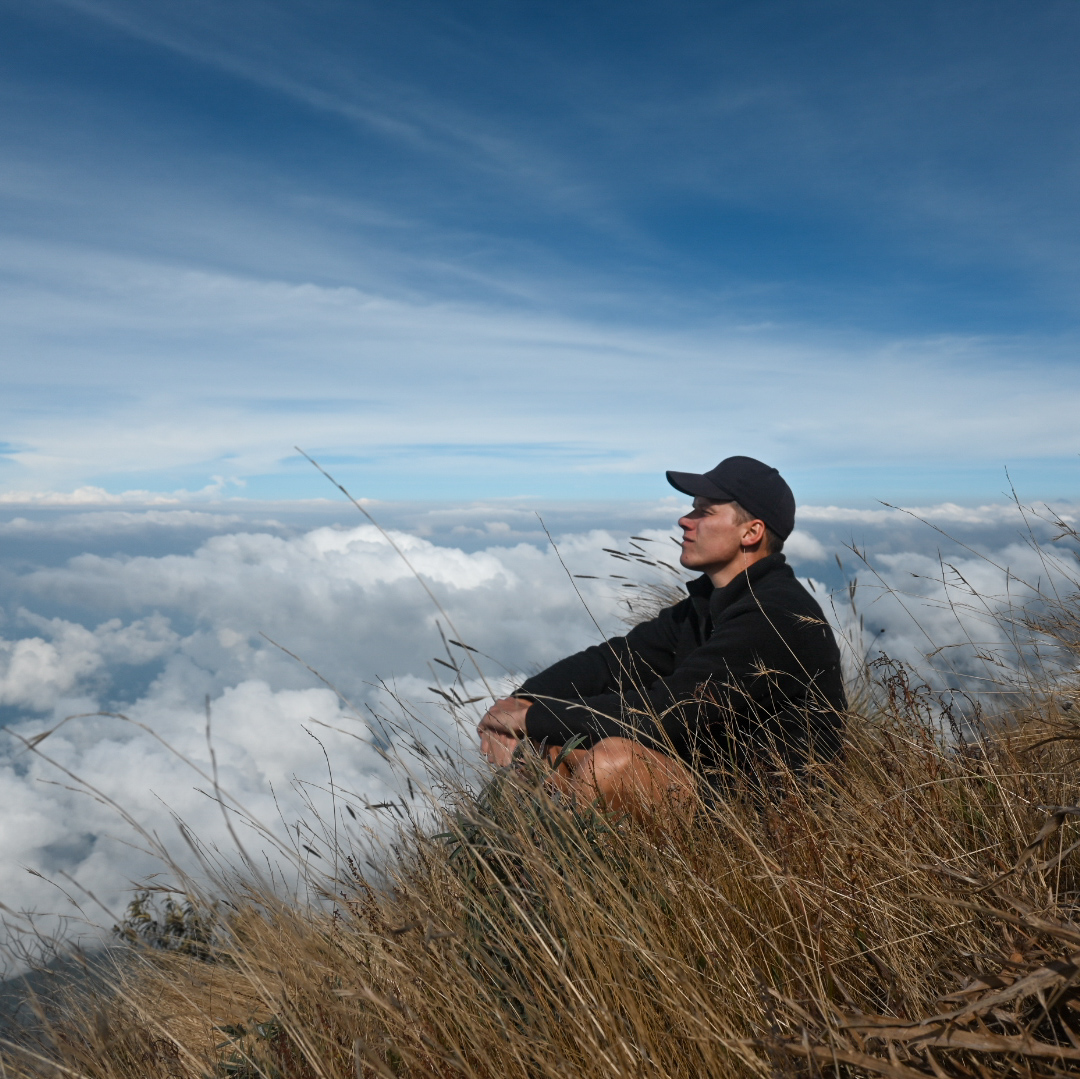
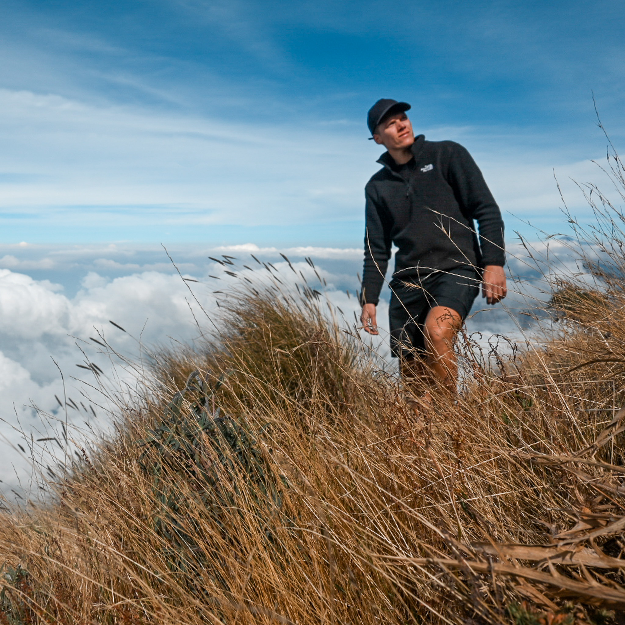
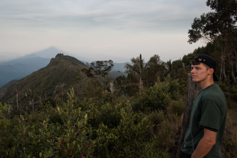
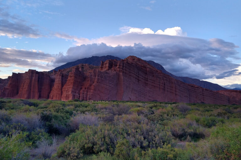
Quetzaltenango (Xela), is a city in western Guatemala surrounded by beautiful volcanoes, such as the Santa Maria volcano which is rising above the city at 3,772 meters (12,375 ft). This is definitely one of the most rewarding hikes in Guatemala, with an unforgettable panoramic view over the regularly erupting Santiaguito volcano.
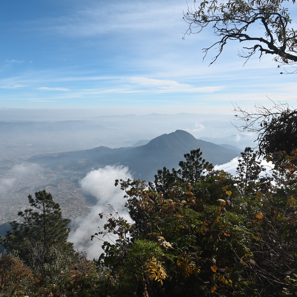
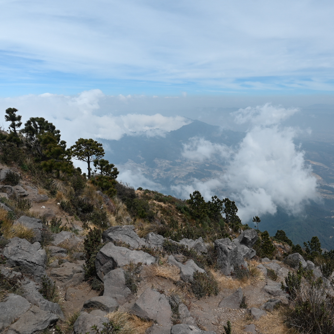
It’s a special hike, at the start you’re walking through misty pine forests, and next, you’re above the clouds with beautiful views, feeling the rumble of volcanic activity beneath the ground.
When to visit?
The best time to hike Santa María is during the dry season, so from November to April. During these months the weather is clearer and more stable. Daytime temperatures range between 10 – 20°C and at the summit 0 – 10°C, so warm layers are essential.
Keep in mind that during the morning it often gets more and more cloudy and afternoon storms are quite common as well, so try to leave Quetzaltenango early in the morning.
I set my alarm for 04:00 and started hiking at 06:00. Even earlier would have been better, because after about half an hour on the top it started to get more and more cloudy.
Why hiking the Santa Maria volcano?
Unlike well known tourist places like Antigua or Lake Atitlán, Xela remains a lesser-known gem. This is a big advantage for those seeking a more authentic and uncrowded hiking experience.
Also, the trail at Santa María Volcano is peaceful, with far less hikers than famous places like Acatenango or Pacaya. This means you can truly experience the natural beauty, views, and stillness of the highlands without all the crowds.
How to get to the trailhead?
The easiest way to get to the trailhead is by using InDrive or Uber. There were plenty of options at 05:00 and I only paid 32 Q, which is about €4. The hostel I stayed at in Xela was Kasa Kiwi hostel (Highly recommend it) and the ride to the starting point was about 7 km, so 20 minutes.
Option two is catching a local bus to Llano del Pinal (the start neighborhood of the hike) which is 8Q so way cheaper. The reason why I wouldn’t recommend this is because the buses start around 06:00, so that would be late considering the fact that very often it gets more and more cloudy during the day. If you want to catch the sunrise this would be too late as well.
Lastly, for safety reasons it might be more wise to take an InDrive or Uber.
The trail: all you need to know
The route is very straightforward. If you don’t have the app Maps.me yet, make sure to download it (it’s free) and to download the west Guatemala map so that you can use it offline.
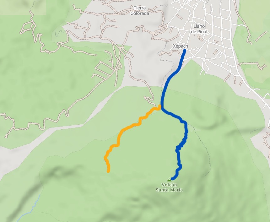
There are basically two trails you can choose from to see the Santiaguito volcano eruptions. The first option is to climb the Santa María volcano (3,761 meters in altitude), or you can hike to the “Volcán Santiaguito Viewpoint” (2,850 meters in altitude). In this guide, I’ll go into more detail about the 3,761-meter hike, and I would definitely suggest doing this hike because the views were absolutely stunning, but keep in mind that if you’re unsure about the difficulty level, you can always opt for the ‘’viewpoint’’ hike at 2,850 meters.
First, when arriving at Llano del Pinal you’ll follow the trail southwards. The only time you really need to pay attention is at the fork after 1,7 km. If you keep left, you’ll hike towards the Santa María Volcano, if you go right, you’ll go to the Santiaguito Viewpoint.
This hike will put your legs to the test, with its average incline of 24.5%. Fortunately, the trail doesn’t start climbing right away, the first two kilometers are a gentle uphill slope, perfect for warming up. The final few hundred meters, however, are extremely steep. You’ll start in a forested area, but the higher you go, the more the trees disappear, opening up to stunning panoramic views.
Details and my honest review
- Total Distance: 12,2 km (7.5 miles)
Start at the trailhead near Llano del Pinal and hike up to the summit and back. - Elevation Gain: 1,395 meters (4,300 feet)
This is a serious uphill climb the whole way, expect sore calves. - Highest Point: 3,761 meters (12,370 ft)
Altitude will slow most hikers down, especially near the top. - Tourist Density: 5/5
Santa María isn’t a major tourist hotspot. You’ll most likely encounter a few locals and maybe another tourist, but very few crowds, especially if you hike on a weekday or start early. - Difficulty Level: 4/5
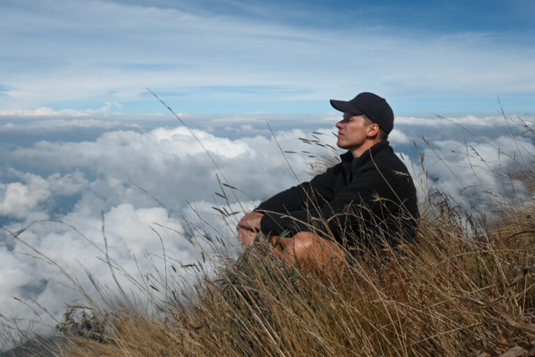
The steep incline, high altitude, and long climb make this a challenging hike. While it doesn’t require technical skills, good fitness and mental stamina are essential. Be prepared for cold, wind, and sun exposure. - Sights: 5/5
With a clear view, the sights are absolutely breathtaking, sunrise above the clouds, and the erupting Santiaguito Volcano below. One of the most unique and rewarding viewpoints in Central America if you ask me. - Wild Camping: 1/5
Camping is technically possible but not common. The summit is exposed, cold, and windy. Also for safety reasons I wouldn’t recommend wild camping here. Most people go for an early morning start instead of camping overnight. Also good to know is that there are no water sources or facilities on the trail.
Gear list
- Your best hiking shoes (good grip is necessary)
- 2 – 3 liters of water (you can’t buy water anywhere during the hike)
- Warm layers for the summit
- Sun protection
- Sunglasses
- Hat or cap
- Rain jacket (the weather can change quickly)
- Maps.me app and the offline map downloaded
- Nuts, bars, chocolate or fruits
- Hiking pole(s). If you have them with you I do recommend them, but they aren’t necessary
My personal experience
This might sound a little crazy, but ..
You’ve probably heard of the world-famous Acatenango volcano hike near Antigua? Personally, the Santa Maria volcano was my favorite hike in Guatemala!
Let me explain why.
First of all, this hike is much less touristy—you won’t run into crowds of people. Furthermore it’s free, you can do it solo, getting to the trailhead is easy, and from the summit you can see an active volcano as well: the impressive Santiaguito.
Another factor might be that during my Acatenango hike, Fuego wasn’t active. Of course, the Acatenango is a beautiful hike, but in my opinion, the Santa María hike doesn’t fall short in comparison.
Starting the hike
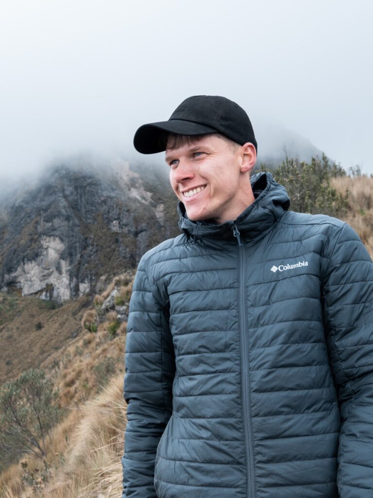
From Kasa Kiwi Hostel, I took an InDrive around 5:30 AM and started hiking exactly at 6:00. After about two kilometers, I met a 63-year-old Guatemalan man who was climbing the Santa María volcano for the 20th(!) time. For many, climbing this volcano holds religious significance. I passed a few Guatemalan women hiking in their traditional clothing, carrying flowers in their hands, which they later place at the summit as an offering—often as a form of prayer or to honor nature and the spirits.
Also, I came across beautiful wildlife: these blue birds called uni-colored jays, a coati, hummingbirds, and lots of lizards. I saw many other birds I had never seen before, though I wouldn’t be able to tell you which species they were.
All in all, if you’re looking for a quieter, unique experience with stunning views and a special vibe, the Santa María volcano hike is totally worth it. It honestly ended up being one of the highlights of my time in Guatemala.
If you’re looking for a rewarding adventure near Xela, the Santa Maria volcano hike won’t disappoint.
Enjoyed this post? Feel free to check out my Instagram, where I regularly share travel stories, hiking guides, and tips and tricks. I’d love to have you along for the journey!
If you have any questions about this hike, feel free reaching out to me on Instagram.
Want to keep reading? You can find all posts here.
– Bart

Indrukwekkend reisverslag Bart. Echt leuk om te lezen. Wat een belevenissen. Wat een prachtige natuur. Heel moedig dat je dit allemaal onderneemt en ook met goede reistips komt. Ga zo door. Heel interessant.
Groeten
Chris
Bedankt amigo! Guatemala moet je op je lijstje zetten, een heel indrukwekkend land.