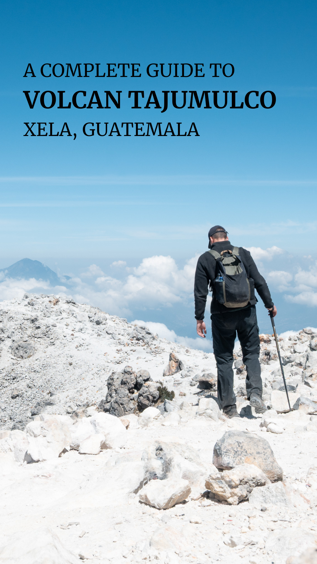
How to hike Volcan Tajumulco: all you need to know.
Standing on the highest point in Central America is an experience you won’t forget. Volcan Tajumulco offers exactly that. Expect a raw, remote adventure with great views.
How to Hike Volcan Tajumulco?
Introduction: How to hike Volcan Tajumulco?
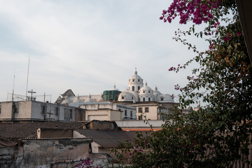
Volcán Tajumulco hiking guide. This 4222 m high volcano is located in Southwest Guatemala, close near Quetzaltenango (Xela).
The Tajumulco Volcano is the highest point of Central-America, making this hike an unforgettable experience.
Getting to Volcan Tajumulco
There are two options: a chicken bus or taxi.
Chicken bus
The first option is to take a chicken bus to the trailhead from the Quetzaltenango bus terminal. This is the cheapest option and will cost around 30–40 GTQ in total. However, the downside is that the journey takes about three hours, which is significantly longer than taking a taxi.
First, from your accommodation, you can take a taxi to the Xela bus terminal. Expect to pay around 15–25 GTQ, depending on your location.
Once you arrive, look for the chicken bus heading to San Marcos. If you’re unsure, locals are usually more than happy to help you out. This part of the journey costs about 20 GTQ. From San Marcos, you can then take another ride to the start of the hike for 10 GTQ.
Taxi
If you’re going solo I wouldn’t recommend going with a taxi, because you can expect to pay around 300 – 350 GTQ (one way). Nevertheless, if you’re with two or more people you can definitely consider going to the trailhead by taxi. This will take about two hours.
Where to stay?
I’d recommend staying at Hotel Villa Real, because this hotel is right next to the trailhead, and will cost 100 GTQ.
Don’t expect a luxurious stay, but there are warm showers and they offer some simple food like chips and cookies.
For dinner, I ate dinner on the opposite side of the road at Restaurante Puerta Al Volcan and the food was surprisingly good.

How to hike Volcan Tajumulco?
Stats and ratings: How to hike Volcan Tajumulco?
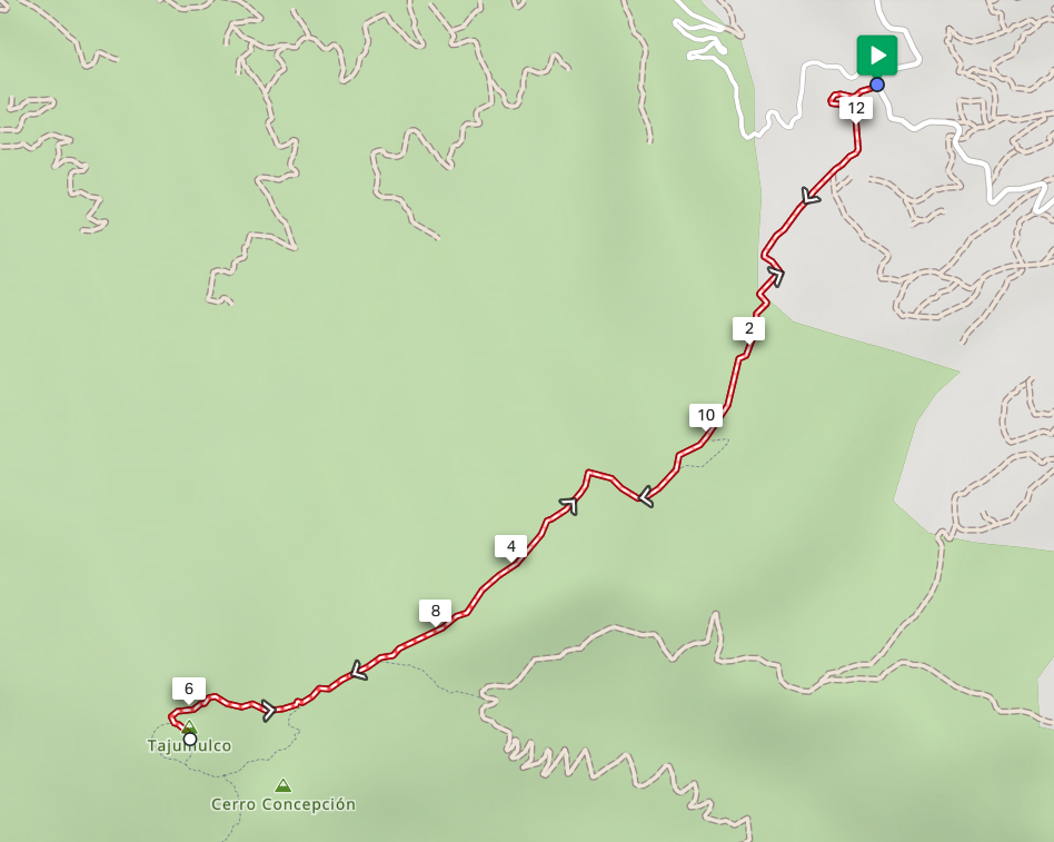
- Total distance: 15,3 km (9 miles)
- 1200 meters elevation gain
- Highest point: 4,222 meters
- Tourist density: 5/5. The whole day I didn’t meet a single other person. Compared to the Acatenango, this hike feels way more remote and wild.
- Difficulty level: 3/5. The altitude and elevation gain make this hike somewhat hard, you’ll need a decent stamina level. But the trail never gets technical or dangerous.
- Sights: 4/5. Absolutely incredible views over the surrounding landscapes. And what’s cooler than being able to say that you were standing on the highest point of Central-America?
- Wild camping: 2/5. Although it’s possible I wouldn’t recommend it. At this altitude it can get very windy, cold, and sleeping at 4,222 meters won’t be comfortable.
How to Hike Volcan Tajumulco?
Trail information: How to hike Volcan Tajumulco?
The trail is pretty straightforward and easy to follow, but be sure to have downloaded the Maps.me app, and the offline map for this region. The trail will get steeper near the end. You’re going to walk back the same way as how you came.
Also, you’ll start the hike at an altitude of 3030 m, and climb all the way up to 4,222 m. Therefore be sure to have adjusted to the high altitude at least two days before attempting this hike.
How to hike Volcan Tajumulco?
In-depth practical guide
DAY 1
Getting to the trailhead
Since the first buses leave quite late from Quetzaltenango (Xela), I decided to leave Xela after lunch and spend the night at Hotel Villa Real near the trailhead.
If you’re going by taxi, you might be able to arrive at the trailhead before 8 am, but with a chicken bus and the 3 hour ride, it’s unfortunately not possible to start the hike early enough.
Tip: Be sure to bring enough cash money, you’ll need this for transportation, food, the accommodation, etc.
Tip: Take breakfast and lunch with you, because you won’t find this near Hotel Villa Real
DAY 2
I recommend waking up early today to avoid walking in the heat. I set my alarm for 5 AM.
At Hotel Villa Real, it’s not possible to eat or buy breakfast, so make sure to bring something with you. The same goes for lunch, as you won’t find any places along the trail to eat, so you’ll need to bring your own food. For example, I went with my good old tuna can with bread, mayonnaise, and some vegetables.
The great thing about this hike is that the hotel is right next to the trailhead, so you can start your adventure immediately.
Starting the hike
This early in the morning, I hardly saw any other people or cars, which makes it feel more special. The lack of crowds gives you that real sense of solitude.
Also, be aware of dogs along the way. They may seem aggressive, but in my experience they didn’t do anything other than bark. Still, it’s a good idea to bring walking sticks so you can protect yourself in case they do have bad intentions.
Tip: A trick I learned is to pretend you’re picking up a stone and about to throw it, this will scare the dogs.
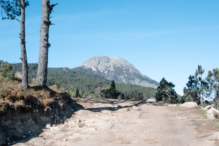
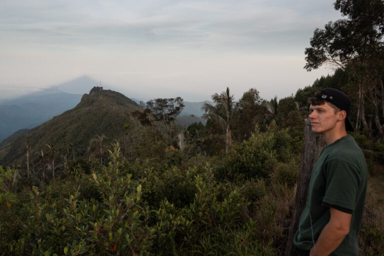
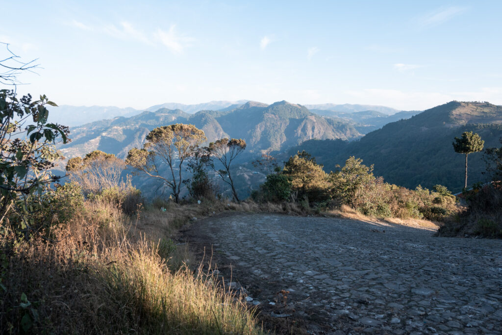
The first part of the hike takes you past a few houses, and you might meet some locals along the way. The trail isn’t very steep here, which makes it a great warm-up for what’s to come.
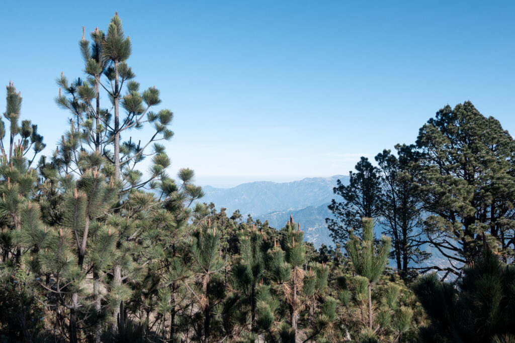
After some time, you’ll reach denser forest and the trail becomes a bit steeper. However, it’s still nothing too crazy, but at this altitude you’ll definitely feel it more.
So just pace yourself and enjoy the beautiful surroundings, the views are absolutely incredible here near the highest point in Central America!
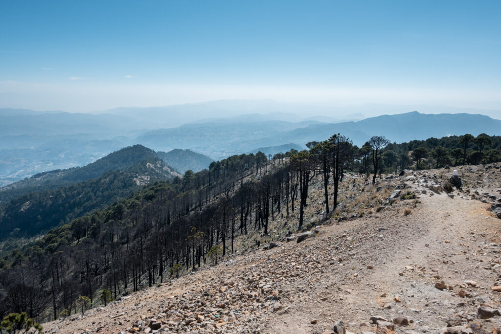
Then, after about 6 km, you’ll reach the campsite. I really enjoyed this part, especially because the views are absolutely incredible here.
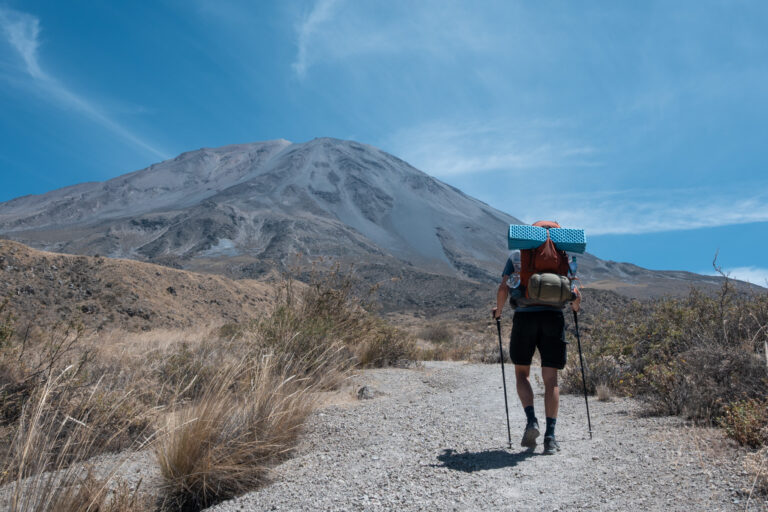
Just after the campsite, it’s time to prepare for the hardest part of the hike. Here, the trail becomes a bit more technical, but nothing dangerous. It also gets a lot steeper near the end, but it’s only a few hundred meters more to the summit.
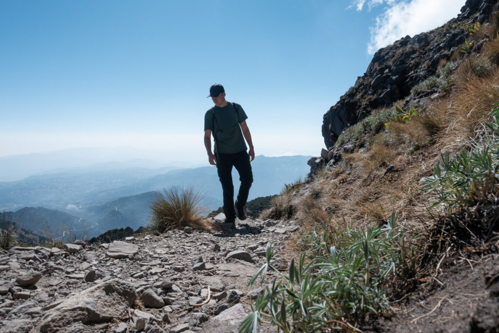
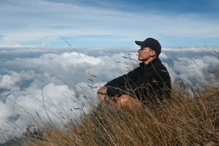
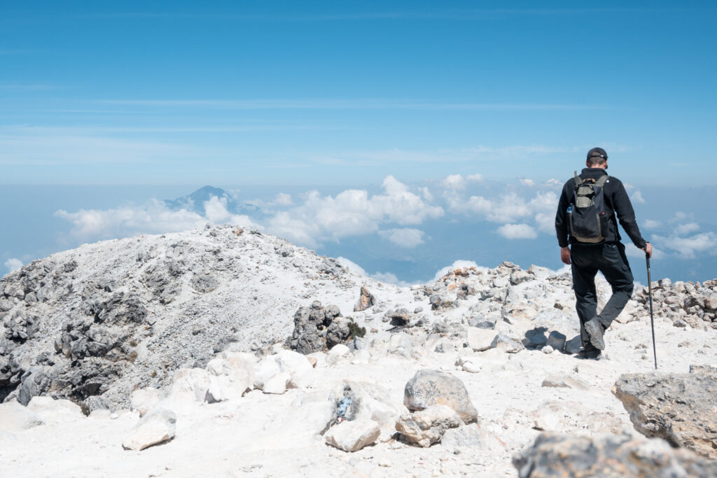
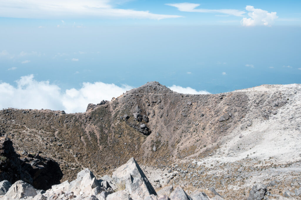
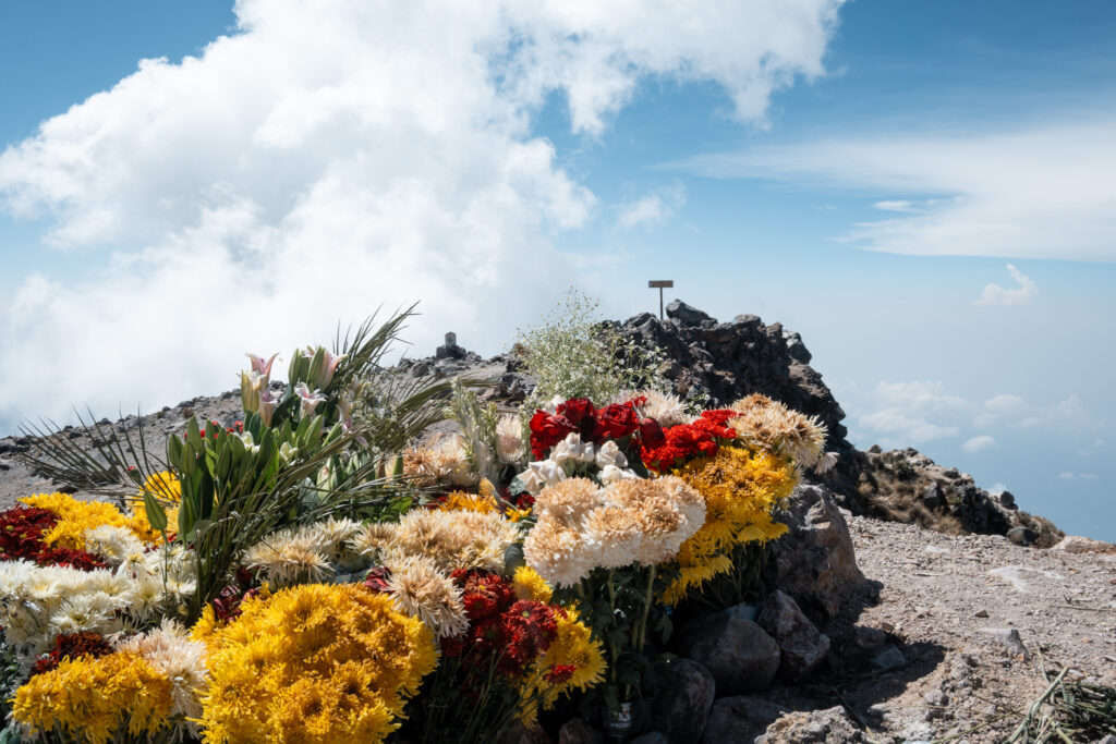
Reaching the Tajumulco summit
Reaching the top of Volcan Tajumulco, you’ll find flowers and a cross, both placed there for religious purposes, giving this place a special and peaceful feeling. The views up here are absolutely incredible.
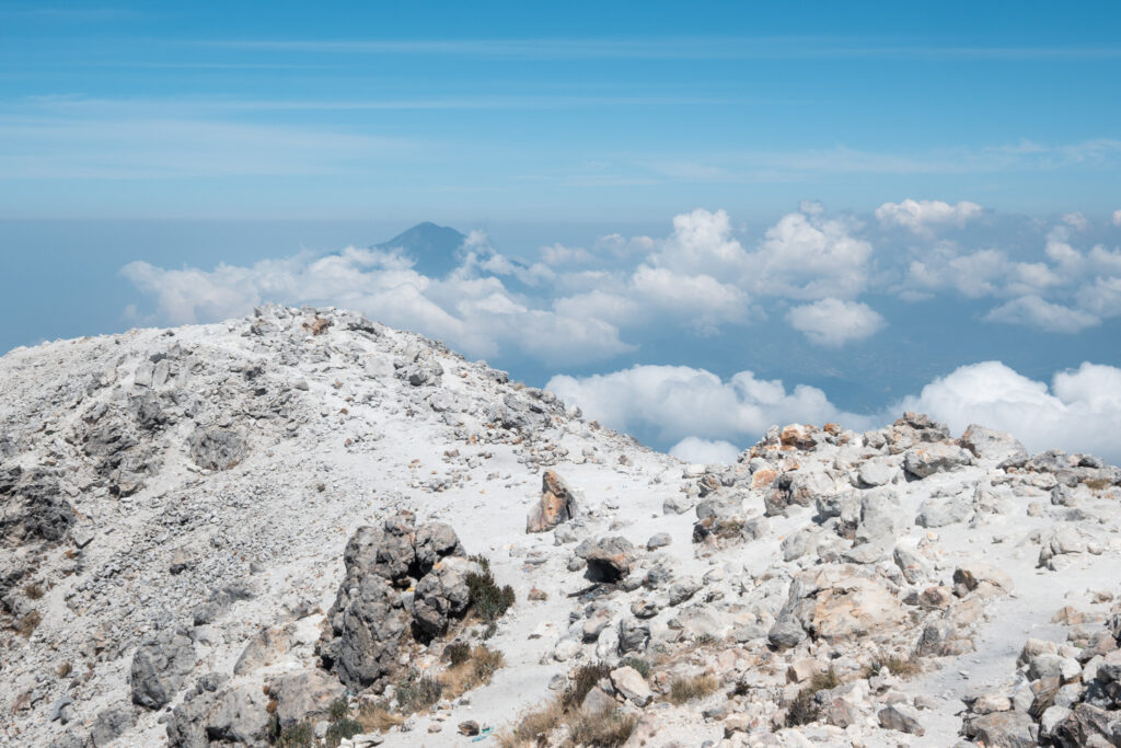
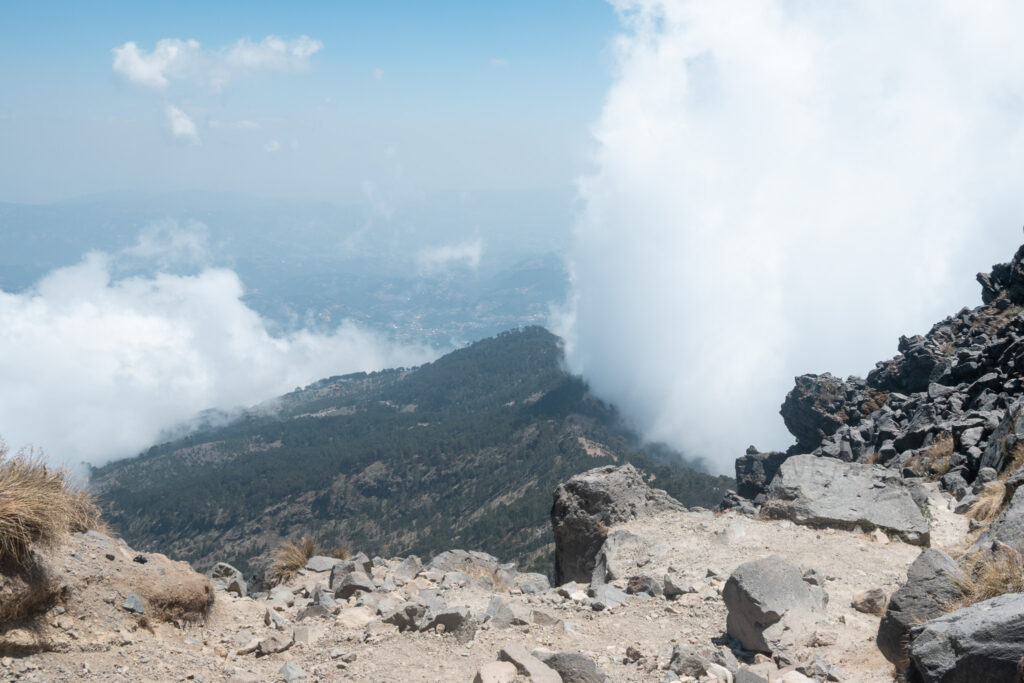
Meanwhile, the clouds move quickly, appearing and disappearing within seconds, which makes the landscape constantly change. One moment everything is covered, and the next you’re rewarded with clear, wide open views.
All around you, you’ll be able to see about six more volcanoes rising above the landscape, which makes you realize again how high you actually are.
Standing here, on the highest point in Central America, is an unforgettable experience, and easily one of the highlights of my time in Guatemala.
Returning to the trailhead
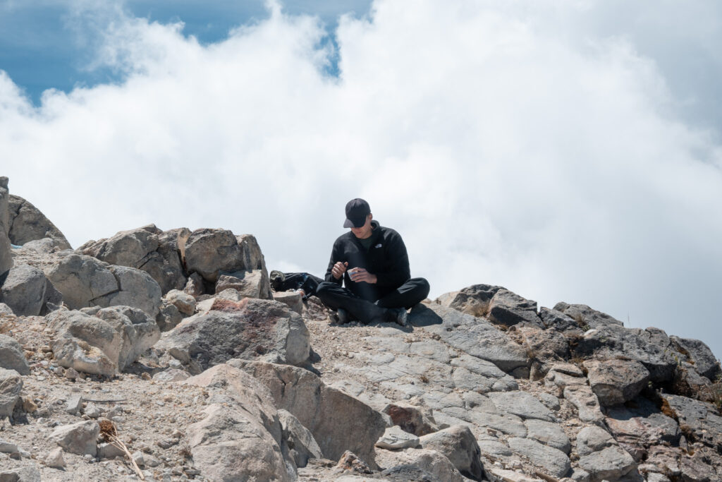
I decided to have lunch at the summit and spent about 1.5 to 2 hours just taking in the incredible views and snapping photos. Going back is very easy, as it’s the exact same route you took to get there.
On the way down, two birds spotted me, and it honestly felt like they were considering whether I was small enough to be their next meal. Luckily, they decided not to.
I’ve shared this whole adventure on my Instagram story, so check it out there to see exactly what this hike looks and feels like.
Returning to Quetzaltenango (Xela)
Returning to Quetzaltenango (Xela) is a bit of a patience game. I waited just north of Hotel Villa Real at the corner, as colectivos and buses stop there. You’ll likely also see a few taxi drivers offering rides to San Marcos, but I chose to wait for a colectivo or bus, since it’s much cheaper.
After about 40 minutes, a colectivo finally arrived. The price was 10 GTQ to San Marcos. From there, you can take a chicken bus back to Xela for 20 GTQ.
Packing List
Conclusion
If you’re looking for a rewarding adventure, hiking Volcan Tajumulco absolutely won’t disappoint.
Did you know that near Xela you can also hike the Santa Maria Volcano? It’s another incredible adventure and a completely different experience. I’ve made a guide for the Santa Maria Volcano hike as well.
Do you have any questions about this hike? Feel free reaching out to me on Instagram.
Want to keep reading? You can find all posts here.
Follow me on Instagram for more travel stories, hiking guides, and bikepacking tips.
I would love to have you along for the journey!
– Bart

Buy me a coffee ☕
I created breakawaywithbart because I love writing, sharing, and helping others plan their own adventures.
This site is completely free of ads and sponsors, on purpose.
If this helped, consider buying me a coffee, I’d truly appreciate it!