[UPDATED MARCH 2026]
Looking for a unique and beautiful hike in the Sacred Valley? The Chinchero to Urquillos hike is a perfect choice.
Chinchero to Urquillos hike: Stats and ratings
- Total distance: 11 km
- Trail info: Point-to-point hike (Walk from Chinchero to Urquillos. Don’t start in Urquillos because then it’ll be almost all the way uphill)
- Total altitude gain: 500 meters
- Highest altitude: 3745 meters
- Difficulty 2/5: The hike doesn’t get technical, but the 12 km distance adds up
- Overall rating: 4/5
The Chinchero archeological site and Poc Poc waterfall provide for an unforgettable experience. Also, you’ll come across a mirador called Mirador del Valle, where you can take beautiful pictures.
Here you can find countless Inca trails, the most famous of which is the Inca Trail to Machu Picchu. However, there are many other lesser-known Inca trails that are now suitable for hiking, including the route from Chinchero to Urquillos.
In short, hiking from Chinchero to Urquillos is absolutely worth it.
Chinchero to Urquillos hike: The Sacred Valley

Chinchero is located near the Sacred Valley, and it’s an absolute must-visit if you’re in the Cusco region. This valley is full of history, charming villages, and great hikes.
In addition, the local population still keeps many traditional ways of life. For example, many locals still wear colorful traditional clothing and rely on farming for their income. Photography lovers will love the Sacred Valley area.
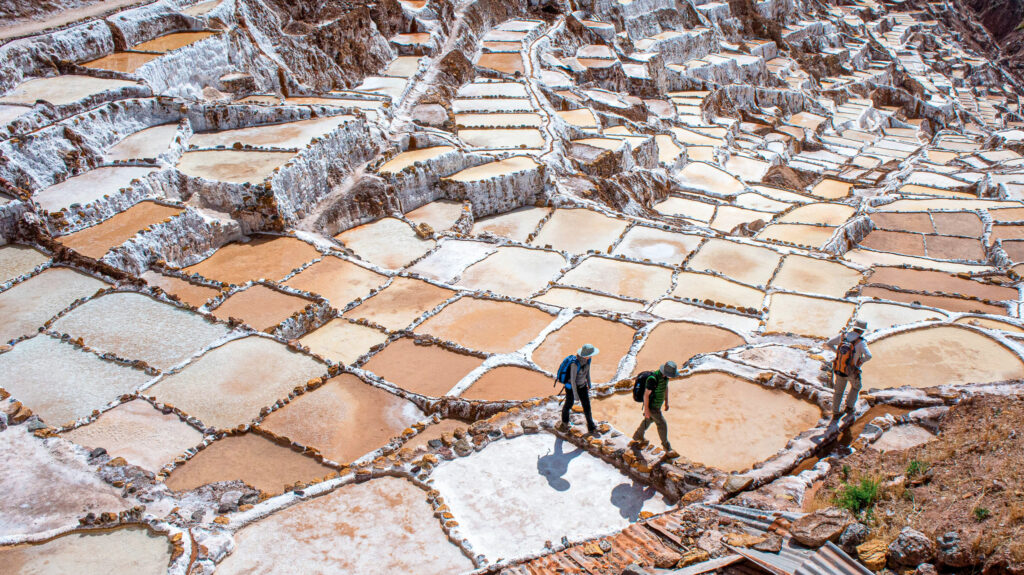
The region is also famous for its many Inca ruins. Some of the most impressive villages include Ollantaytambo, Pisac, and Chinchero. Other highlights worth visiting are Moray, the Salineras de Maras, and the Perolniyoc waterfall.

How to get to Chinchero?
There are two options: you can either take a colectivo (shared ride) or a taxi. There’s quite a big price difference. A shared van costs about 7 soles per person, while a taxi will costs around 50 to 70 soles, depending on the number of passengers.
I had a general idea of where to find colectivos, but not the exact spot for those going to Chinchero. Several drivers may approach you on the street offering rides to Chinchero at higher prices. They can sometimes be a bit pushy, so don’t be tricked by them.
Where to find the colectivos?
The colectivos are located here: opposite El Tuco Hostel, just south of Puente Grau. Near the intersection of Miguel Grau street and Jirón 21 de Mayo.
You can also take the colectivo to Urubamba and simple hop off in Chinchero.
The driver will drop you at Plaza de Armas in Chinchero, from there it’s only a short walk to the trailhead and archeological site.
At the end of the hike, you will end up in the small town of Urquillos. Walk across the bridge and wait for a colectivo or bus heading to your destination. Keep in mind that the colectivos and buses are active until 20:00 (8:00PM).
Chinchero to Urquillos hike: Trail info
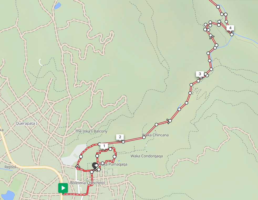
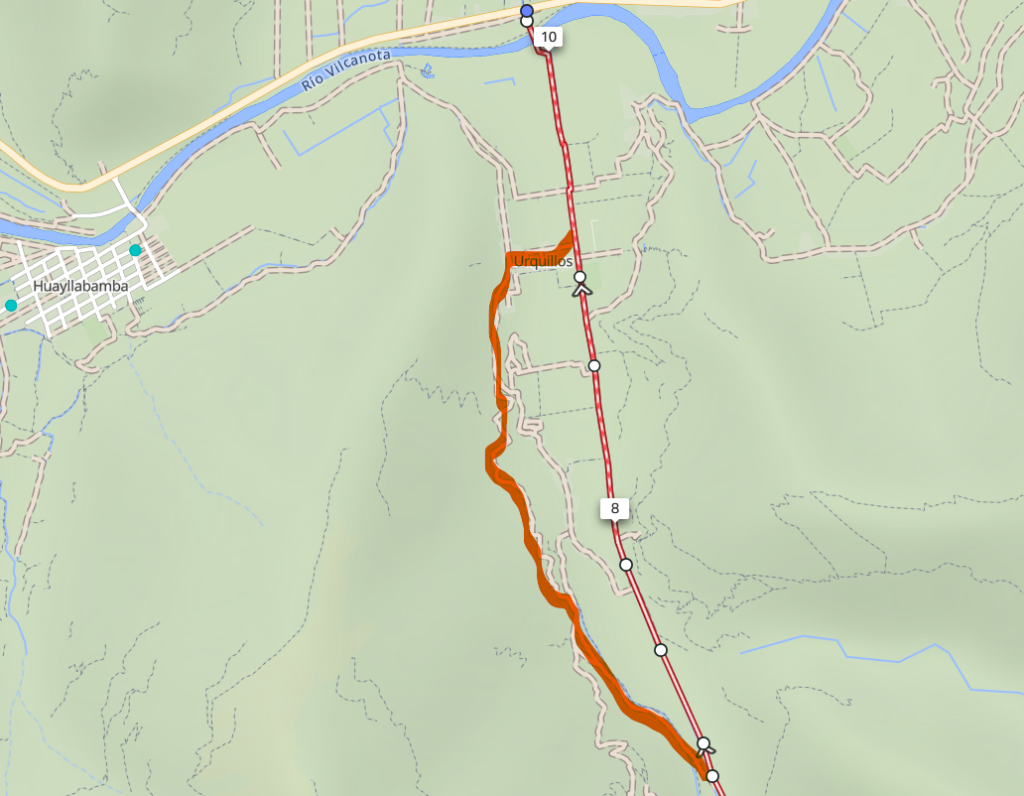
The route starts just southwest of the historical site, in the Maps.me app, you can easily find the trailhead of this hike.
One advantage is that this route is mostly downhill, which makes it easier. However, since it’s largely downhill, you’ll likely feel some pressure on your knees toward the end of the hike. Make sure not to overload them and take it easy.
Also, by using hiking poles, you can help take some pressure off your knees.
Finally, keep in mind that the hike starts at an altitude of almost 3,750 meters, so be sure to adapt for a day or two to the high altitude.
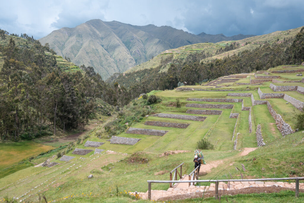
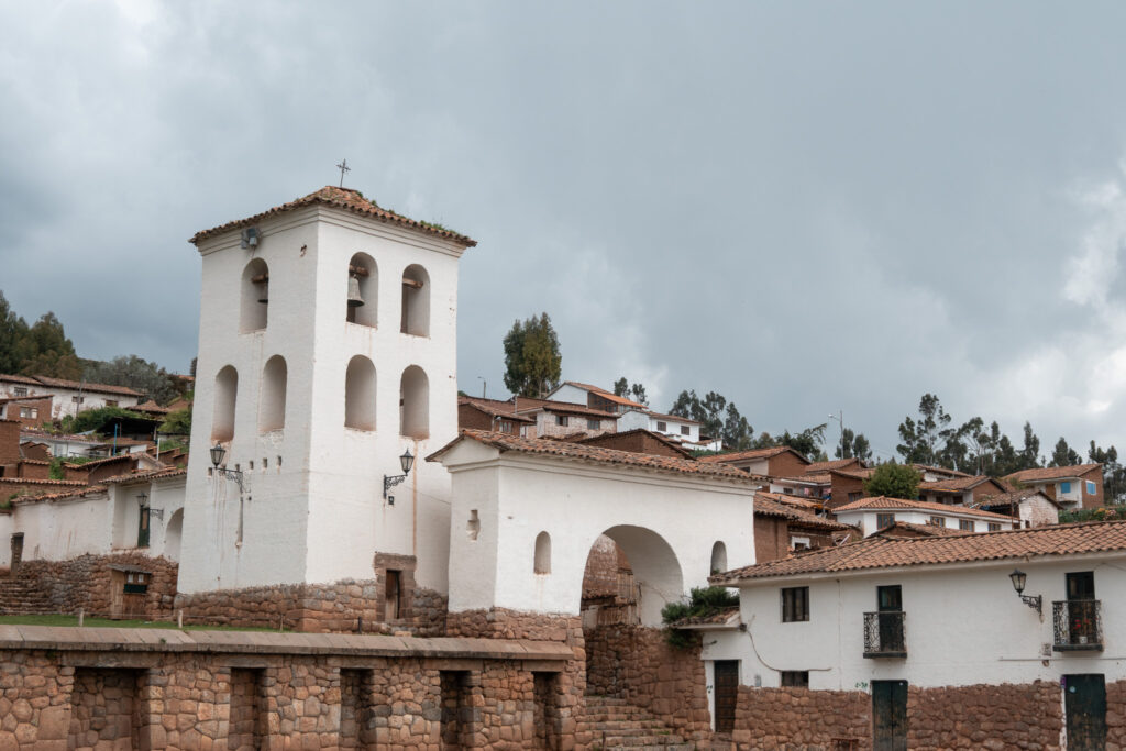
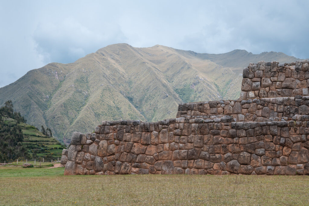
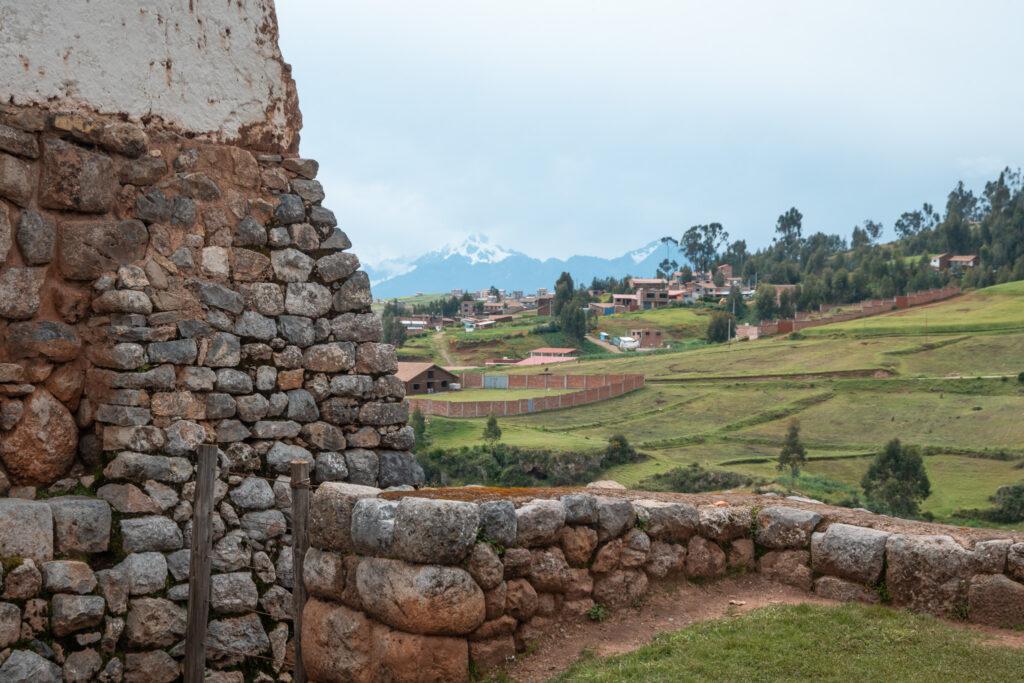
Chinchero Archeological Site
I do absolutely recommend visiting the historical site in Chinchero, as it is a beautiful place to start the hike.
While in Chinchero, you’ll likely see locals in traditional clothing selling all kinds of souvenirs, and there’s a good chance you’ll also spot alpacas and llamas along the way.
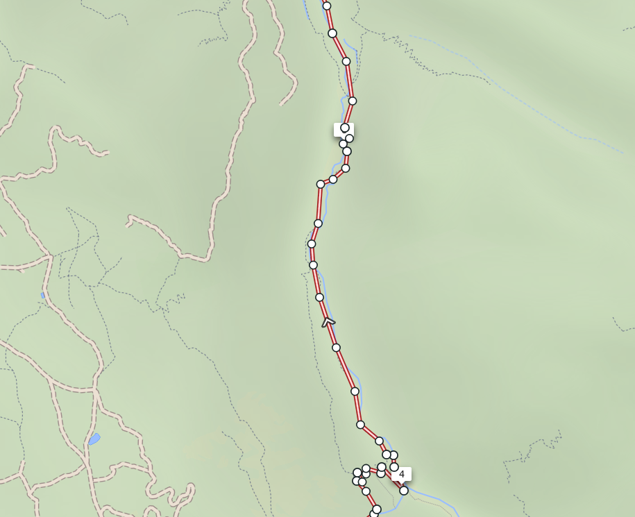
From there, the path is easy to follow. Early on, you might come across other hikers heading to the Poc Poc waterfall. However, afterwards, the trail becomes much quieter. For navigation, I recommend using the free Maps.me app.
Along the way, you’ll pass the site and get a great view of it. If you have time, it’s definitely worth stopping. If not, you can still catch a glimpse from the trail.
Make sure to bring enough food and water, as there are no shops along the way.
I did this hike in May, when the forest was lush and dense; however, toward the end, the views begin to open up, revealing Urquillos in the distance.
Since this hike isn’t that popular, you won’t encounter many people, which is something I personally love about this trail.
Chinchero to Urquillos hike: Practical tips
- Bring some cash money for the Poc Poc waterfall entrance.
- Bring mosquito spray.
- If it’s warm, bring a hat and sunscreen.
- Bring water and food because you won’t encounter shops along the way.
- Make sure your shoes have enough grip, the hike is steep at times.
- Download the Maps.me app, and the offline map for this region.
- You can consider leaving for Chinchero one day in advance. That way you won’t stress in the morning, and you have enough time to visit the archaeological site.
Conclusion
If you’re looking for a rewarding adventure near Cusco, the Chinchero to Urquillos hike absolutely won’t disappoint. Do you have any questions about this hike? Feel free to reach out to me on Instagram.
Want to keep reading? You can find all my posts here.
Follow me on Instagram for more travel stories, hiking guides, and bikepacking tips.
Want to keep reading? You can find all posts here.
I would love to have you along for the journey!
– Bart